

Scientific context
The Larzac karst is located in the Grands Causses region, south of the Massif Central. The studied aquifer lies within Middle to Upper Jurassic limestone and dolomitic formations, approximately 400 m thick. These formations rest on the Upper Lias marly series, which acts as an impermeable barrier and defines the lower boundary of the saturated zone of the karst system. Recharge from rainfall, over an estimated area of around 100 km², infiltrates through the plateau soils at an elevation of 750 m, while discharge occurs at the Durzon spring, located at 530 m. This spring, with an average flow rate of 1.4 m³/s, naturally supplies drinking water to the Aveyron part of the Larzac. During certain exceptional rainfall events, temporary lakes form south of the recharge area, suggesting that the unsaturated zone (epikarst and infiltration zone) does not have the same hydraulic properties in the south as in the north. The main scientific objective concerns the dynamics of water transfer and storage primarily within the unsaturated zone. The site is mainly managed by the Géosciences Montpellier (GM) laboratory.
Localization: 43°96′ N; 3°22′ E, Causse du Larzac, France
Start: 2006
Website: https://oreme.org/observation/gek/
Database: https://data.oreme.org/
Supervisor: Cédric Champollion (GM)
Keywords: karst aquifer, infiltration zone, transfer, recharge zone.
Scientific goals
The overall goal of the project is to gain a better understanding of the processes which control the spatial and temporal variations in the supply of water in karstic environments, by in situ observation of the hydrologic, geophysical, and geodesic parameters associated with water flows within the karst. The following points in particular will be investigated:
- The respective roles played by the unsaturated zone (epikarst and infiltration zone) and the submerged zone. We propose to make a particular study of the epikarst, for which research has demonstrated a significant contribution over several seasonal and interannual cycles.
- Water infiltrates the unsaturated zone in a multi-modal fashion, including slow diffusion in the porous media, and more or less rapid travel in microfissures and cracks. We would like to characterize the respective contributions of the various modes of transport in terms of characteristic variations in water mass and travel time.
- A multidisciplinary approach to the epikarst and the infiltration zone based on structural, petrophysical, and hydraulic studies of these units. The project employs the additional tools of geodesy (gravimetry and tiltmetry), and geophysics (electrical, seismic, and proton resonance techniques) both on surface and in boreholes, and also hydrogeology. It also applies in situ geodesic and hydrogeologic observation tools.
- Investigations of the highly heterogeneous karstic environment raise the problem of the changing scale of our observations. We are currently installing a “local” experimental site where integrative methods of investigation, such as gravimetry, will be compared against geophysical observations made on surface and in boreholes.
- On a larger scale, the Larzac karst constitutes a system whose limiting hydraulic conditions are well known. We will offer an overall circulation model combining the various modes of transport and the observations made at different scales, particularly the spatio-temporal variations of gravity at the regional scale.
Instrumentation and measurements
The Larzac Karstic “Observatory” is equipped for gravimetric and tiltmetric observations for investigating spatio-temporal variations in water storage and the associated sub-surface deformation This instrumentation is supplemented by other geodesic (GPS), meteorologic, and hydrogeologic tools, designed to make local determinations of 1) vertical ground movements; 2) the spatio-temporal distribution of rainfall on the karst; 3) variations in the depth of the submerged zone; and 4) the temporal characteristics of water flow in the infiltration zone. The data collected are highly diverse (temperature, discharge, gravimetry, GPS, inclinometry, water vapor, CO₂, etc.) with very variable sampling frequencies (from 100 Hz to one measurement per hour). Most data are acquired continuously over long periods. For gravimetry, GPS, seismology, and atmospheric fluxes, the aim is to work at different time scales to capture seasonal cycles and climate changes (>10 years).
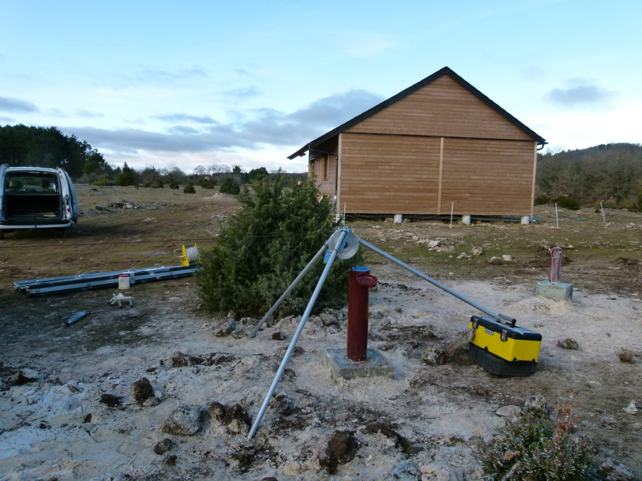
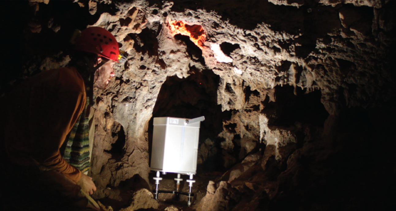
The equipment allows for gravimetric observations (absolute gravimeter at three sites with a measurement cycle of less than two months, vertical differential gravimeter at one site on a semiannual cycle, and a high-precision gravimetric network of 40 stations on a semiannual cycle) and inclinometric observations (three underground hydrostatic inclinometers), enabling analysis of the spatio-temporal variations in water storage and associated subsurface deformation. These measurements are complemented by a hydro-geodetic observatory comprising a superconducting gravimeter, an electrical tomography system, a seismometer, two GPS stations, three underground rain gauges, three boreholes equipped with CTD sensors, five surface rain gauges, a borehole fluorimeter, as well as two limnigraphs—one underground (aven de la Bise at –110 m below the surface) and the other at the Durzon spring at the surface. Finally, the site is equipped with a surface flux tower and an ADSL connection for near real-time data transmission and remote instrument monitoring.
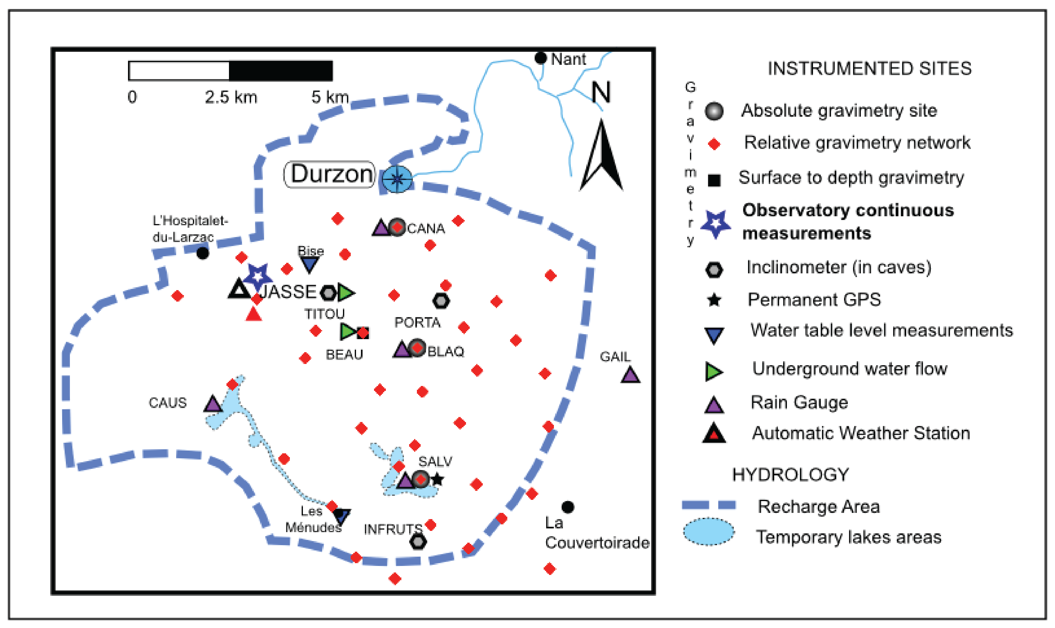
Gravimetric observations rely on instruments from the GMOB mobile gravimetric network. The absolute gravimetric sites of the “Larzac Observatory” are integrated into the national gravimetric baseline Montpellier–Observatoire du Mont Aigoual, allowing calibration of national relative gravimeters as well as those from foreign institutes. The observatory also conducts inter-comparisons of different relative and absolute gravimetric instruments. Significant efforts are made in the areas of data transmission (GSM for the GPS station and inclinometers) and inclinometer design (interferometric measurement). The GPS stations at La Salvetat and La Jasse are integrated into the RENAG network.
Partners
The observatory’s monitoring of the Durzon spring discharge is carried out by the Parc Naturel des Grands Causses, while the Géosciences Montpellier laboratory ensures rainfall monitoring, measurement of groundwater flows, deformation measurements associated with recharge using inclinometers, and gravity measurements at both surface and underground sites. Complementary hydrological and geochemical monitoring is provided by the Hydrosciences Montpellier laboratory. The ambition of the Durzon site is to become an infrastructure capable of hosting various national and international projects related to the geophysical, geodetic, and hydrological observation of karst systems.
Projects and publications
Projects are available here, and publications here.
Data access
KMZ viewer
The viewer below offers a comprehensive site visualization and information on available public data such as types, numbers and dates of measurements, locations of sites, wells and stations, as well as data providers information. This interface also provides an overview of available geophysical maps and cross-sections.
To visualize all data in the Google Earth software, you can download the following KMZ file: Larzac.kmz
OSURIS catalogs
In this OSURIS catalog you can find links to key datasets of the site together with metadata:
Predefined requests
To help finding general datasets, predefined database requests have been created and are regularly executed. Results of the requests can be downloaded from the links available below.