

Berambadi catchment
Tropical ecosystems are impacted by the increase in human population and are associated with rapid changes in climate and land use, leading to the degradation of water and soil resources in these regions. Multiscale TROPIcal CatchmentS (M-TROPICS) observatory aims to quantify the matter balance of a range of river basins of contrasting and complementary vegetation cover and land use in Cameroon, India and Southeast Asia.
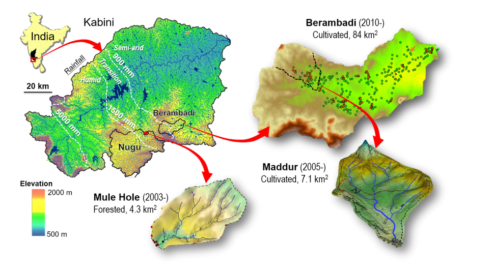
In Southern India, the impact of groundwater-irrigated agriculture in a subhumid cimate is adressed by comparing an agricultural experimental basin (Berambadi, 80 km2, 11°47’5N et 76°39’3E) with a preserved forest experimental basin (Mule Hole, 4.1 km2, 11°720N, 76°420E), both located in the Kabini river basin on the Deccan Plateau, within the sub-humid zone of the strong climatic gradient induced by the Western Ghats in southwestern Peninsular India. Monitoring of the site began in 2005 in the Maddur sub-basin and was extended in 2010 to cover the entire Berambadi River basin.
More information can be found on the M-TROPICS observatory website. Additional hydrogeophysical data are available for the Mule Hole catchment as well as sites in Laos (Houay Pano) and Cameroun (Nsimi).

Data access
KMZ viewer
The viewer below offers a comprehensive site visualization and information on available hydrogeophysical data, including geophysical maps and cross-sections. This interface also provides details on the types, numbers, and dates of measurements, as well as precise site locations and data providers information.
To visualize the data in the Google Earth software, you can download the following KMZ file: Berambadi.kmz
Predefined requests
You can access the data categorized by different types of measurements from the provided links below: