

Scientific context
The HydroScan observatory is located in a small wetland (16 km²) bordering the Seine River and located in the commune of Notre Dame de Bliquetuit in the Parc naturel régional des Boucles de la Seine Normande. The site is instrumented to follow the hydraulic variations that occur in three different hydrofacies. The first is a free aquifer in the modern alluvium, composed of fine sands, silts, and peats, with a variable thickness that can exceed 20 m. The second is a semi-confined aquifer formed in a gravel layer with a thickness of 2 to 6 m and characterized by a very high permeability. This aquifer is hydraulically connected to the third hydrofacies, a chalk aquifer, which is the main drinking water resource of the region, thanks to a well-developed network of karstic channels.
The modalities of water flow in the chalk aquifer are controlled by the architecture of the karst conducts, which channel most of the water flow and ensure drainage of the alluvial deposits. The three aquifers are hydraulically connected to the Seine River, which is under the influence of tides whose amplitude can locally reach 4 meters. This connection is confirmed by the piezometric responses, particularly those of the karst and gravel aquifers, which exhibit tidal variations. These hydrodynamic conditions lead to the triggering of flooding phenomena, especially during episodes of rising karst water levels that coincide with high tidal coefficients. The HydroScan observatory, monitored by people from UMR M2C from the Unviersity of Rouen Normandie (URN), provides ideal conditions for conducting studies on both porous and fractured aquifers. Moreover, due to its particularities, it allows the study of the interface processes between the three compartments of the hydrosystem (aquifer, river, unsaturated zone).
Localization: 49°29′ N; 0°45 E′, Normandie, France
Start: 2002
Web site: https://www.hydroscan.cnrs.fr/
Database: https://hplus.ore.fr/acces-donnees/
Supervisors: Abderrahim Jardani (scientific supervisor) and Romain Levaillant (technical supervisor)
Keywords: karstic chalk; aquifer-river interactions, wetland, flood events.

Scientific goals
These scientific issues can be organized according to these three main axes, which will be the subject of collaboration with national and international multidisciplinary teams:
- Axis 1 : Multi-scale hydrodynamic characterization of aquifers (karstic/porous) by hydro-geophysical coupling,
- Axis 2 : Understanding, modeling and predicting hydro-bio-geochemical flux exchange between river and aquifers in the macrotidal domain,
- Axis 3 : Studying of the mechanisms of flooding in a wetland
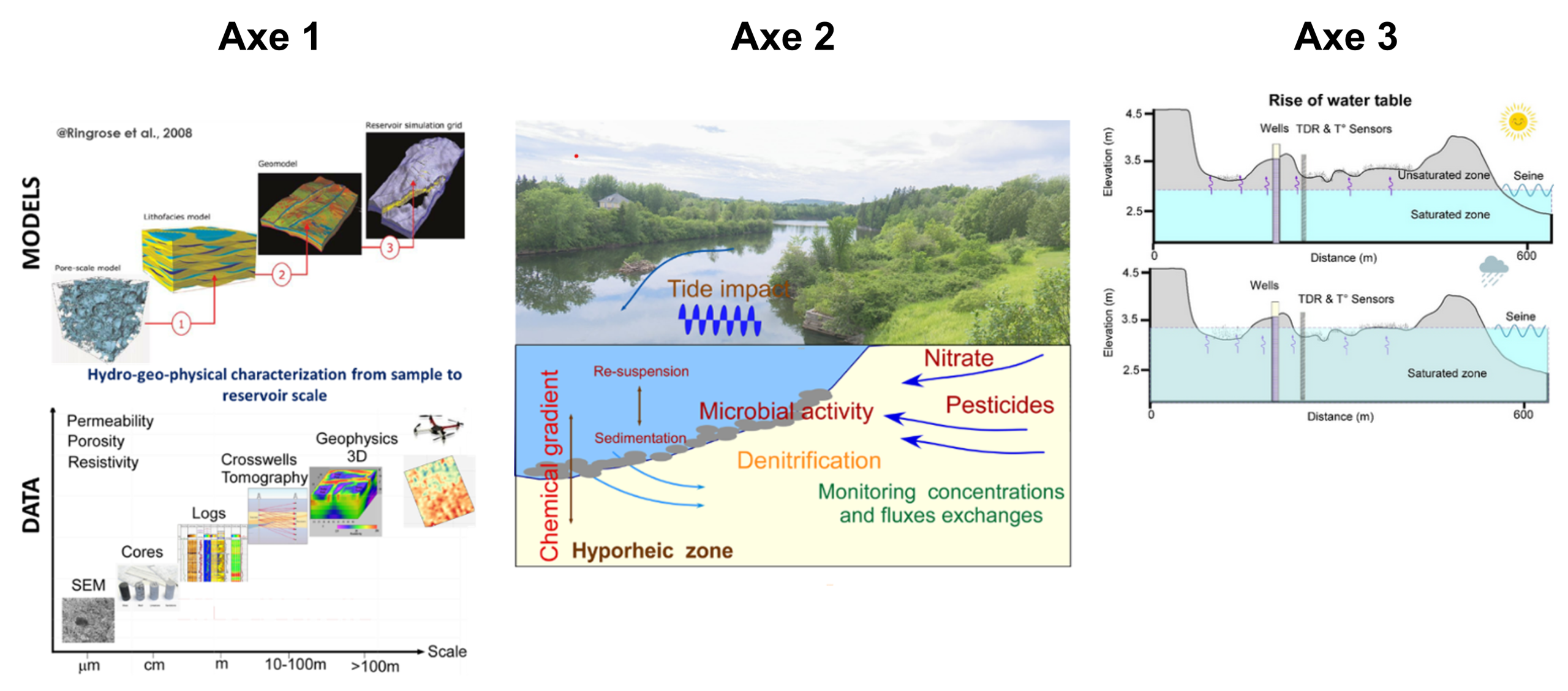
To do so, the observatory aims to improve our knowledge of :
- Different modalities of water, chemical and microbiological transfer in the hydrosystem,
- Degree of heterogeneity of the hydrodynamic parameters of the porous alluvial deposits and the fractured chalk substrate and their evolution at different spatial scales, as well as their impact on the hydro-, bio-and geochemical fluxes in the drowned zone,
- Interactions between the aquifers and the Seine River and how tides affect the exchange of hydrochemical fluxes between the two compartments,
- The contribution of time-lapse geophysical imagery (airborne/ground/wells) in reconstructing hydrofacies heterogeneity, identifying piezometric fluctuations and monitoring water content changes,
- Optimal assimilation strategies of geological, hydrogeological, geophysical, and chemical data acquired in different compartments and at different spatio-temporal scales in the construction of physical numerical or statistical learning models to simulate hydrochemical flows,
- Flooding process of the water table and hysteresis phenomena related to the saturation and desaturation of its beaten zone as a function of meteorological and marine (tidal) influences.
Instrumentation and measurements
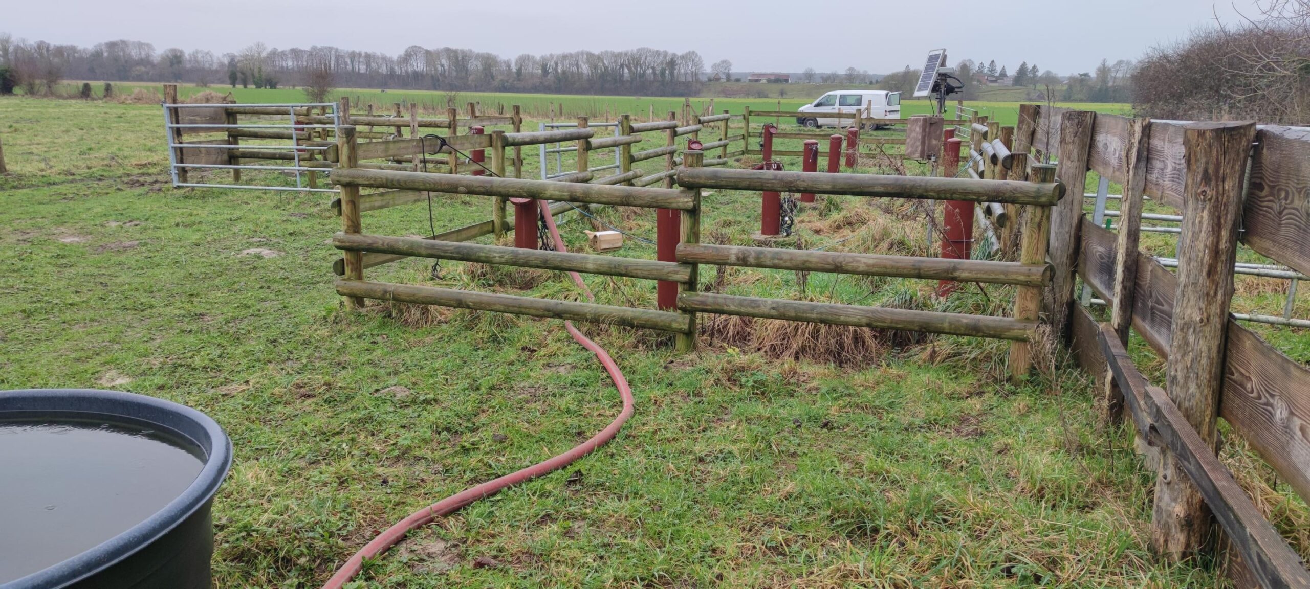
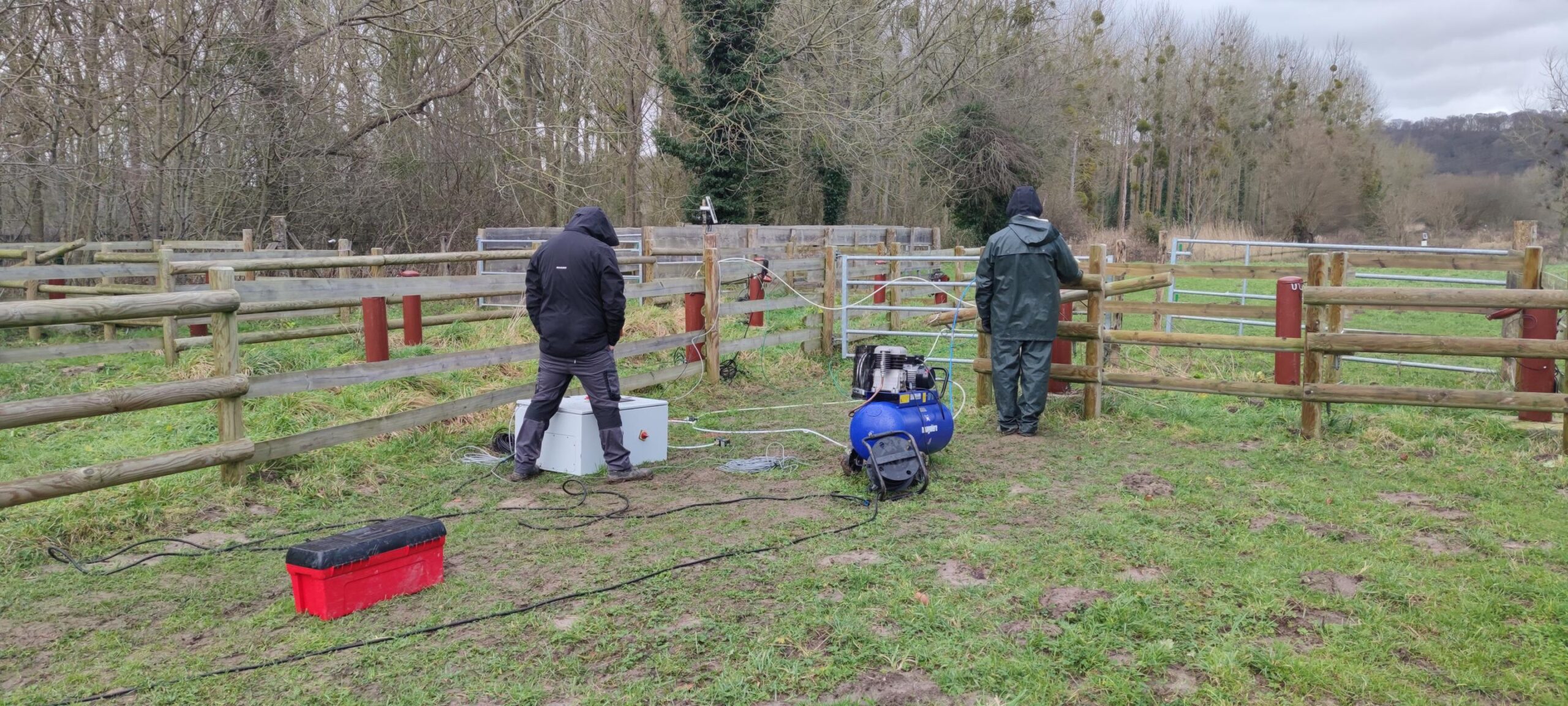
The site consists of 29 piezometers and two cores. All piezometers were drilled at three different depths to follow the hydraulic variations that occur in three different hydrofacies. To record hydrodynamic exchanges between the aquifers and the Seine, piezometers were installed on a profile perpendicular to the Seine, to which several probes and automatic water samplers are positioned to monitor chemical and microbiological indicators and variables that can change according to water cycles and tides. In addition, a series of wells were placed at close distances from each other to ensure an optimal configuration for hydrogeological and geophysical investigations and to capture the spatial heterogeneity of the hydraulic properties of the three aquifers. The HydroScan site is equipped with a remote-transmission system for data acquired by various sensors.
Partners
The observatory, through its involvement in the SNO H+ network, aims to attract the interest of national and international multidisciplinary scientific communities, including mathematicians, geophysicists, geochemists, ecologists, hydrogeologists, and biologists. HydroScan brings together a broad community of scientific and public-sector stakeholders, including the Université de Rouen Normandie, the federative structureFR SCALE, the Normandie region, the Agence « Eau Seine Normandie », Métropole Rouen Normandie, the Parc Naturel Régional des Boucles de la Seine Normande, and EDF.
Projects and publications
Projects are available here, and publications here.
Data access
KMZ viewer
The viewer below offers a comprehensive site visualization and information on available public data such as types, numbers and dates of measurements, locations of sites, wells and stations, as well as data providers information. This interface also provides an overview of available geophysical maps and cross-sections and is accessible without a database account.
To visualize all data in the Google Earth software, you can download the following KMZ file using the H+ database account: Hydroscan.kmz
Predefined requests
To help finding general datasets, predefined database requests have been created and are regularly executed. Results of the requests can be downloaded from the links available here: