

Scientific context
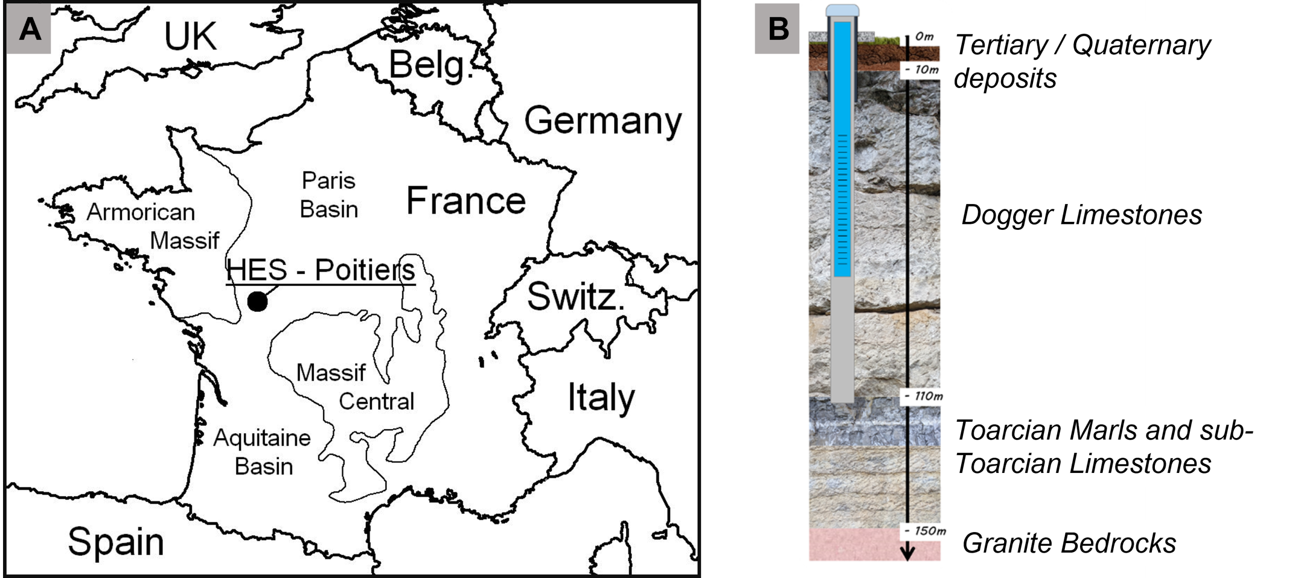
The Poitiers Hydrogeological Experimental Site (HES) is located on the northern slope of the ‘Seuil du Poitou’ geological structure, a vast Mesozoic carbonate plateau marking the transition between the Aquitaine and Parisian sedimentary basins. The Jurassic limestones, which are laid on a crystalline Hercynian basement, contain two superimposed aquifers: (i) the Lower and Middle Lias aquifer (10 to 15 m thick), and (ii) the Dogger aquifer (100 m thick). These two aquifers are separated by the Toarcian marl aquitard (20 m thick). The studies carried out on the HES focus mainly on the Dogger aquifer. The HES is located in the watershed and hydrogeological catchment area of the Clain, a river crossing the Vienne and Charente regions and flowing northwards to reach the Vienne River in Châtellerault. The Lias and Dogger aquifers supply the Clain River with groundwater throughout the year. The majority of the catchment area is used for farming (~70%, mainly cereals, oilseeds, protein crops and fodder) and forestry (~15%). The Dogger aquifer is covered by a layer of soil of varying thickness at the HES, ranging from a few meters to around twenty meters. It is a Luvisoil over detrital clay-silt formations that are highly heterogeneous both laterally and vertically. This soil acts as a buffer at the soil-vegetation-atmosphere interface.
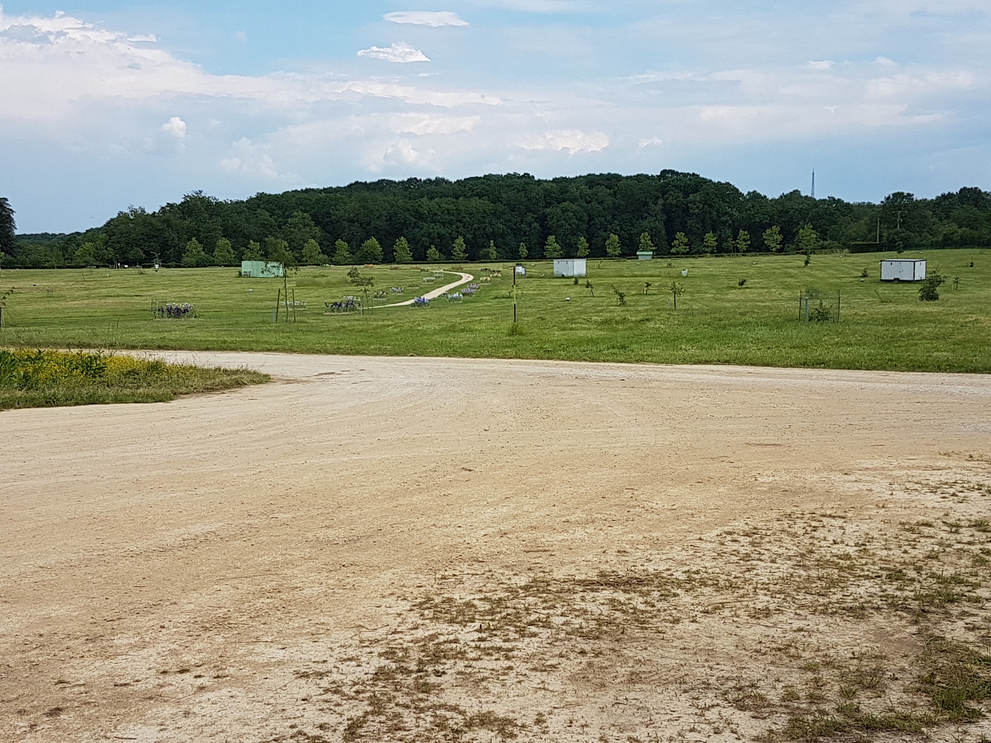
The terrain is relatively flat, forming plateau with an average altitude of 115 m between the Clain and Vienne Rivers, whose run-off have dug the limestone. The climate around Poitiers is semi-oceanic. The average annual temperature in Poitiers was 11.8°C between 1990 and 2010, rising to 12.2°C between 2000 and 2020. The average annual rainfall of 690 mm in Poitiers has remained more or less constant since 1950. This rainfall is unevenly distributed across the Vienne region, with wetter areas in the south, towards the ‘Seuil du Poitou’, and drier areas in the north. Located 2 km to the east of the Science Campus of the University of Poitiers, the HES covers an area of 12 hectares on a land belonging to the University (University Botanical Garden – Deffend site).
The HES was developed by the IC2MP/Hydrasa team (UMR CNRS 7285) as part of the National Network of Hydrogeological Sites (SNO H+) and the ‘EAUX’ programs of the former Poitou-Charentes region (CPER 2002-2006 and 2007-2013).
Localization: 46°33′ N, 0°23′ E, Poitiers, Vienne, France
Start: 2002
Website: https://hplus.ore.fr/poitiers-2/
Database: https://hplus.ore.fr/acces-donnees/
Supervisors: Jacques Bodin and Pierre Fischer
Keywords: deep aquifer, Dogger limestones, heterogenous aquifer, selenium.
Scientific goals
The themes developed at the HES can be divided into two main axes:
Axis 1 : Characterization of preferential flow structures
- Characterization and modelling of flows in highly channeled heterogeneous environments thought the development of new data acquisition approaches that can be used to stress the network of preferential flow channels at different temporal and spatial scales,
- 3D spatial distribution of heterogeneities by using geophysical imaging techniques (seismic, electrical, magnetic, etc.) in order to determine the individual geometry of discrete structures of high relative permeability,
- Parametrization of the boundary conditions (inlet/outlet) throught the investigation of medium- and long-distance propagation of pressure disturbances outside the HES by setting up ‘remote’ sensors and carrying out pumping experiments with periodic signals.
Axis 2: Transfer of water and dissolved elements to the water table
- Hydrological balance and recharge monitoring throught the combination of a micrometeorological monitoring (including a weather station and a fluw tower) for the quantification of quantification of evapotranspiration and water transfers to the underground environment (infiltration) and geophysical methods (time-lapse electrical resistivity tomographic measurements and pits equipped with water content probes and buried electrical quadrupoles) for the characterization of infiltration fluxes over time and space,
- Origin and dynamics of selenium in carbonate aquifers based on detailed physico-chemical characterization (XRD, SEM, XPS) of the speciation of the selenium present in the filling pockets, the characterization of the selenium release mechanism(s) from the solid matrix using laboratory experiments (static and dynamic) coupled with thermodynamic simulations, and the numerical modelling of reactive flows at the reservoir scale.
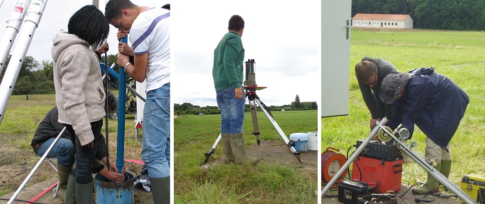
Instrumentation and measurements
The experimental framework comprises around forty boreholes, including three vertical and two oblique core holes, distributed in a regular grid within a 210 × 210 m square. All the boreholes are 125m deep and cross the entire Dogger aquifer. The HES boreholes are either uncased or equipped with casings that are screened throughout the thickness of the Dogger aquifer. Therefore, the piezometric level in the boreholes corresponds to an average hydraulic head over the thickness of the aquifer. Under natural flow conditions, piezometric levels vary from 15 m to 25 m below the ground surface. During drilling, dry clayey limestone was systematically observed down to a depth of around 30 m, indicating that the Dogger aquifer is confined beneath this low permeable formation. Two additional boreholes were drilled down to the crystalline basement (boreholes C2 and IM1, approximately 160 m deep), in order to be able to record the hydraulic head in the Lower and Middle Lias aquifer during the hydraulic tests carried out in the other boreholes. No pressure disturbance was ever observed in the Lower and Middle Lias aquifer, demonstrating that the two aquifers are well isolated from each other by the Toarcian marls.
The atmospheric fluxes of the water cycle (rain, evapotranspiration) is measured by a weather station installed in 2002 and a flux tower installed in 2023. Equipped pits, dug up to 2 m below the surface, are used to monitor water content every 30 cm vertically in the soil since 2024.

Since 2002, the investigations carried out at the HES have made it possible to collect a large amount of data concerning the Dogger aquifer. This dataset, now archived in the H+ database, concerns both continuous and one-off acquisitions.
Continuous acquisitions :
- Piezometric monitoring at 10-minute intervals in HES boreholes
- Micrometeorological monitoring at 30-minute intervals: rainfall, temperature, humidity, wind speed, solar radiation, real evapotranspiration, etc.
- Monitoring of soil water content and temperature at 30-minute intervals, every 30cm to a depth of 2m (in 4 pits close to the micrometeorological station)
One-off acquisitions :
- Groundwater dynamics under ‘natural’ and/or induced flow conditions: pumping tests and hydraulic shocks
- Transport dynamics (non-reactive) in pumping condition: fluorescein tracing experiments
- Hydrogeophysical imaging of the unsaturated zone: one-off or time-lapse electrical resistivity tomography profiles
- Flow structure in boreholes: vertical flowmetry; temperature-conductivity logs
- Geological structure of the reservoir: stratigraphy/lithology on core drillings, 3D seismic imaging of the reservoir, gamma ray logging, acoustic imaging, high-resolution camera
- Petrophysical properties of carbonate rocks: laboratory measurements of porosity and permeability on core samples
These various investigations have made it possible to achieve an unequalled degree of characterization at the national scale for this type of environment.
Partners
The SEH is managed by the IC2MP/Hydrasa team (UMR 7285) and serves as a training site for students.
Projects and publications
Projects are available here, and publications here.
Data access
KMZ viewer
The viewer below offers a comprehensive site visualization and information on available public data such as types, numbers and dates of measurements, locations of sites, wells and stations, as well as data providers information. This interface also provides an overview of available geophysical maps and cross-sections.
To visualize all data in the Google Earth software, you can download the following KMZ file: Poitiers.kmz
OSURIS catalogs
In this OSURIS catalog you can find links to key datasets of the site together with metadata:
Predefined requests
To help finding general datasets, predefined database requests have been created and are regularly executed. Results of the requests can be downloaded from the links available here:
Water cycle
- Piezometry: 2003, 2004, 2005, 2006, 2007, 2008, 2009, 2010, 2011, 2012, 2013, 2014, 2015, 2016, 2017, 2018, 2019
- Pumping tests: Pumping rates, Drawdown: 2002, 2003, 2004, 2005, 2007, 2009, 2011, 2012, 2013, 2014, 2015, 2016, 2017
- Slug tests, Cross-borehole slug tests – M6
- Flowmeter tests
- Hydraulic parameters
- Air temperature, Humidity, Solar radiation, Pressure, Rainfall, Wind
Geochemical cycles
Borehole hydrogeophysics
Spatialized hydrogeophysics
Experimental bench
Boreholes and stations
- Boreholes location
- Geological logs
- Core samples information and photos
- Technical logs*
- Stations location
* From August 2020, 9 wells m7, m8, m13, m15, m20, m22, mp4, mp6 and mp7 become m7b, m8b, m13b, m15b, m20b, m22b, mp4b, mp6b and mp7b respectively due to a change in their technical equipment.