
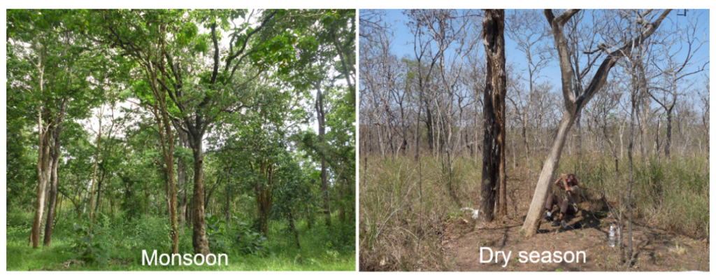
Bassin versant de Mule Hole (Moole Hole)
Les écosystèmes tropicaux sont impactés par la croissance démographique de la population humaine, associée à une évolution rapide du climat et de l’usage des terres, conduisant à la dégradation des ressources en eau et en sol de ces régions. L’observatoire Multiscale TROPIcal CatchmentS (M-TROPICS) a pour objectif de quantifier les bilans de matière d’un ensemble de bassins au couvert végétal et occupation des terres contrastés et complémentaires, au Cameroun, en Inde et en Asie du Sud-Est.
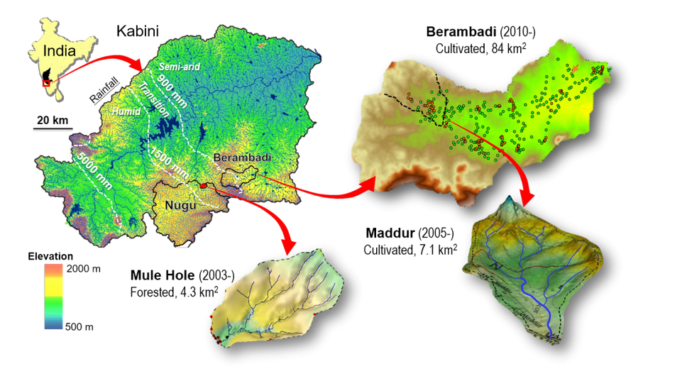
En Inde du Sud, l’impact de l’agriculture irriguée par les nappes phréatiques, en contexte sub-humide, est abordé par une étude comparative entre un bassin expérimental agricole (Berambadi, 80 km2, 11°47’5N et 76°39’3E) et un bassin expérimental forestier préservé (Mule Hole, 4.1 km2, 11°720N, 76°420E), tous deux localisés dans le bassin de la rivière Kabini au sud-ouest de la Péninsule Indienne.
Veuillez trouver plus d’informations sur le site de l’observatoire M-TROPICS. Des données hydrogéophysiques sont aussi disponibles pour le bassin versant de Berambadi, ainsi que pour les sites situés au Laos (Houay Pano) et au Cameroun (Nsimi).
Accès aux données
KMZ viewer
Le viewer ci-dessous offre une visualisation complète du site et des informations sur les données hydrogéophysiques disponibles, y compris les cartes géophysiques et les coupes transversales. Cette interface fournit également des détails sur les types, les nombres et les dates des mesures, ainsi que les localisations des sites et les informations sur les fournisseurs de données.
Pour visualiser les données dans l’application Google Earth, vous pouvez télécharger le fichier KMZ suivant : Mule Hole.kmz
Requêtes prédéfinies
Vous pouvez accéder aux données classées par différents types de mesures à partir des liens ci-dessous :